|
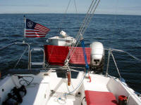
This was probably the most enjoyable day of
pure sailing along
the entire voyage, with a brisk SW wind coming off the shore and light
seas. I used the motor only to leave the Merrimack River (with a
just turned outgoing current) and through the Annisquam River, virtually
mandatory. (Aug. 13) |
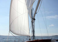 |
Chip Ahoy reached speeds of 5 and 5½
knots most of the day under sail alone in very comfortable seas.
It doesn't get any better! It was a good last day anyway, and a
nice way to reach home at last. |
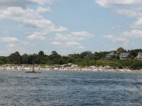 |
Off the Annisquam Harbor lighthouse on Ipswich Bay I
lowered sails and cranked up the swing keel before entering the mouth of
the narrow, shallow, twisting river. In this photo, crowded
Wingaersheek Beach is a short distance off Chip Ahoy's starboard side. |
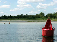 |
The river gets shallow in spots, the channel close to
shore, but is easily navigable if you pay attention to navigation buoys
and your chart. |
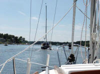 |
I got lucky and could follow another sailboat down much
of the river, still checking my own chart. |
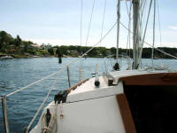 |
The river is well-marked with navigation buoys, but they
are often so close together that it can become confusing -- so you must
note their number while passing and make sure you're heading for the
correct next one. Usually there are many in sight ahead. |
 |
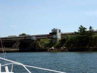
The first of three bridges heading toward Gloucester
Harbor, over Route 128, is plenty high enough for anything with a
shallow enough draft to travel the river to clear. It's the next
two that can become tricky. |
 |
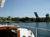
The first of those is the railroad bridge, which is open
unless a train is approaching -- which was the case when I arrived.
I was told to "stand by" by the bridge operator over VHF channel 13 when
I radioed ahead of my approach. |
 |
Once the train passed, the operator quickly raised the
bridge again and advised me to proceed. At this particular bridge,
his advice is necessary -- as getting beneath it requires a 90°
turn: You can't see any boat traffic coming from the opposite
direction. |
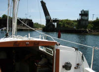 |
Lining up with the narrow channel beneath the bridge in a
favorable current is often tricky, but I had a mild current to head
into, providing all the steerage needed. In my opinion, this was
the perfect current to travel the Annisquam River, the one I'd hoped
for. There's one more bridge, over state Route 127, just before
entering Gloucester Harbor. I was told to "stand by" upon
approaching it as well -- and did for about ten minutes against the mild
current -- until vehicle and pedestrian traffic was halted and the
bridge raised. Once under that, I was into Gloucester Harbor. |
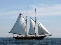 |
A beautiful Gloucester schooner off to Chip Ahoy's port
side as I left Gloucester Harbor behind. |
 |
Back out on the open ocean was like entering a different
world -- even the wind direction had changed, now coming out of the SE.
I was back onto my familiar cruising grounds at last, almost didn't need
a chart in front of me any longer! Kettle Island is ahead to Chip
Ahoy's starboard. I arrived back home on Chip Ahoy's mooring a few
hours later, at 5:30 pm, hallelujah! |
|
See Chip Ahoy's complete log of the cruise
 |
|