|
|

Chip Ford's 1974 Catalina 22
Restoration Project
Sail #3282 l Marblehead, Massachusetts |
|
Only three days to the vernal
equinox and Spring '07 . . .
if you can believe it!
March 17, 2007
After a week of balmy weather which saw sunny
temperatures climb into the high 60s, no one could be blamed for
thinking spring had arrived, perhaps early but teasing us
nonetheless. Tease it has done, giving us but a taste of
what's to come eventually but isn't about to happen yet.
This is, after all, New England in mid-March. (See:
The Storm of March
12, 2005)
Yesterday the Boston Herald reported ("Sign
of spring? Mass. braces for big storm"):
The Bay State is bracing for some wicked
wintry weather this weekend, as a major storm slams the
region starting this morning, according to the National
Weather Service.
“This is a very complicated storm, one of the more
complicated storms we’ll see,” said Glenn Field, a
meteorologist with the National Weather Service.
The nor'easter is still raging out there at
5:00 am, but has now turned to heavy rain, making a real sloppy,
heavy
mess with flooding anticipated. Hopefully, most the snow
will be washed away by the rain, melted with a few days of
warmer weather, gone without a trace but mud.
The only good to be said about snowstorms
this time of year is -- the evidence, even this 8" of now
compressed slush, doesn't stick around very long. Unlike
the squall earlier this month -- another soggy one that turned
into concrete-like ice for about a week with the Arctic blast
that followed, the coldest period all winter -- this mess
shouldn't last long. But beware, "famous last words"!
Worst comes to worst, I've got my
Yaktrax -- more essential than even snowshoes can be this
winter!
As winters in New England go, compared to
some this hasn't
been a bad one to endure. It's been more a problem of
freezing solid what little snow has fallen.
March 18, 2007; 8:20 am
The worst case scenario is here. The
slush froze solid again last night. I just went outside,
it's 23° out there. I needed
to stretch on the Yaktrax just to keep my footing on rock-solid
ice. Cleaning up that driveway so I can get in more
firewood from the racks will definitely be a problem unless if I
can get Donovan the construction/plowing company to get back
here to his truck today and finish the job: I need the wood in
here soon.
Yesterday, after shoveling out a path from
what used to be my driveway around the front of the house to the
side door, where I cart in the firewood, I ran the Blazer in
4-wheel drive up and down the unplowed driveway, spinning its
wheels. If the sun doesn't reach color to warm up the
ground, it only reflects off and the white snow and never melts.
I'd hoped -- since the plowing company did such a poor job --
that it would melt before it froze. There was too much far
too heavy snow/slush to shovel, and it was too wet to use the
snowblower.
|
| Click
thumbnails below for a larger picture |
|
 |
|
 |
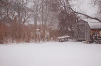
The backyard just before dusk, wind NE gusting to 40 mph.
Mar. 16, 2007 |
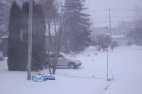
The frontyard just before dusk, wind NE gusting to 40
mph.
Mar. 16, 2007 |
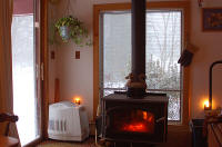
But warm and cozy inside.
Mar. 16, 2007 |
 |
 |
 |
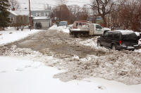
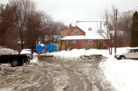
Looking out the driveway lot after our plow guy came
through -- sort of.
Mar. 17, 2007 |
From the street toward the house.
Mar. 17, 2007 |
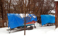
Chip Ahoy (Carpe Diem behind) alongside the house.
Mar. 17, 2007 |
 |
 |
 |
Why did the plow stop here?
Mar. 17, 2007 |
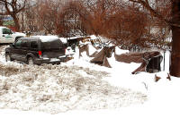
The woodpile rack covers took a beating under the heavy,
wet snow.
Mar. 17, 2007 |
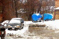
Yesterday, while it was still slushy, I ran the
Blazer in 4WD back and forth breaking through the snowpile left by the lousy plow
job. (The plow truck is parked in front of my Blazer in this shot.)
Mar. 18, 2007 |
 |
 |
|
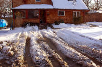
This morning the ruts are frozen like concrete again.
It's impossible now to pull a cart of firewood from the racks to the
path I shoveled out yesterday.
Mar. 18, 2007 |
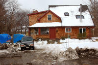
The plow returned at 3:00 pm (after a few phone calls
from me), and got the lot and driveway squared away. Now it's just
a matter of letting the rest melt.
Mar. 18, 2007 |
|
Enough with winter already,
bring on spring!
|
The Boston Herald
Saturday, March 17, 2007
Snowstorm knocks Hub cold:
Deluge, slush in forecast today
By O’Ryan Johnson
Scores of accidents clogged
snow-packed roadways in and around Boston yesterday as
the second major winter storm of the season thundered
across the state.
North of Boston was hardest hit, as Interstates 495 and
93 - covered by state troopers in Andover and Concord -
were littered with spinouts, rollovers and cars off the
road, but fortunately no significant injuries were
reported, said state police Lt. Bill Power.
Accidents backed up Massachusetts traffic far into the
Granite State.
“I got a call from a guy who said he was sitting in
traffic in New Hampshire at the 14-mile marker,” Powers
said.
The National Weather Service in Taunton predicted the
snow would first change to rain, then to sleet and
freezing rain late last night, leaving Boston with five
to nine inches of heavy snow accumulation.
Today, the forecast looks just as bad, but with heavy
rain rather than snow falling before noon, accompanied
by temperatures around 36 degrees and wind gusts of 19
to 22 mph.
The National Weather Service issued a gale warning
through this morning for seas from the Merrimack River
to Rhode Island, predicting wind gusts of up to 45 knots
with visibility less than a nautical mile.
The Coast Guard has the 270-foot cutter USCG Campbell on
standby in the middle of Cape Cod Bay, where Cmdr.
Charles Richards said last night it was 28 degrees and
the water was “slushing up pretty good.” He said the
seas are expected to reach 18 feet sometime today. He
said portions of his 100-strong crew are de-icing the
deck in preparation for freezing conditions.
“There’s talk of 12 footers out there, and it’s building
to 18 tomorrow,” said Richards, predicting a bumpy ride.
“We would make it. It would be very uncomfortable, but
the ship can take it. It would not be a fun experience.”
The Boston Globe
Saturday, March 17, 2007
Snow hobbles evening commute
By Christine McConville
Near white-out conditions and
slippery, snow-slicked roads combined to make last
night's commute slow and ugly.
The region's roadways, police said, were riddled
with minor weather-related accidents.
"It's slippery," said Quincy police Sergeant Steve
Kring, as officers responded to a rash of emergency
calls. After receiving nine calls about car crashes
or spinouts, officials decided to equip all cruisers
with snow chains.
"We also have sanders and plows out," Kring said.
"With everyone coming home from work, they're doing
the best they can."
The Massachusetts State Police said that drivers
were traveling about 20 miles an hour on highways in
Greater Boston and that most of the accidents were
caused by drivers trying to drive the posted speed
limit. The snow began to fall about noon, and by the
evening rush hour, heavy white flakes were falling
fast.
"It's snowing hard everywhere," Hayden Frank,
meteorologist at the National Weather Service in
Taunton, said about 5 p.m.
New Hampshire was especially hard hit.
Meteorologists predicted as much as 20 inches of
snowfall in the northern part of the state, and, in
anticipation of heavy snowfalls, several communities
postponed Saturday town meetings. Also, Democratic
presidential hopeful Barack Obama canceled a
gathering scheduled for tonight in Keene.
As evening progressed, snow gave way to sleet. The
sleet was expected to turn into heavy rain, which
forecasters predicted would fall into the
early-morning hours.
"The heaviest precipitation will be over by
daybreak," he said.
The melting snow and rain is expected to block
drains and cause some flooding in low-lying streets
and near small streams. "If a flood happens, we're
prepared," said Peter Judge, spokesman for the
Massachusetts Emergency Management Agency.
Throughout yesterday, when as many as 8 inches fell
in Greater Boston, the Massachusetts Highway
Department flooded roads with equipment to treat
roads, spokesman Erik Abell said.
By midafternoon, the department had 2,700 pieces of
equipment treating roads statewide, and more were
expected to be added as the night went on.
"We'll continue aggressively treating the roads
throughout the night," he said.
Shortly after 4 p.m., the state's Department of
Conservation and Recreation declared a snow
emergency and prohibited vehicles from parking on
the department's many roadways.
The storm caused other problems. Newton police said
a man lost three fingers in a snowblower.
A series of crashes just over the Massachusetts
border in New Hampshire affected traffic on
Interstate 93, causing backups in northern
Massachusetts.
Lawrence police Sergeant Robert DiBenedetto said
there were only minor problems in his city. "It's
been pretty good so far," he said at 6 p.m.
Even public transit was hobbled by the snow: The
MBTA's Riverside Line experienced 25-30 minute
delays yesterday afternoon due to an inbound train
disabled at Woodland Station on the Green Line.
Emergency responders weren't taking any chances. By
late afternoon, the state's Emergency Response Team
-- which includes a battery of state and federal
agencies -- was ready and assembled in Framingham.
"If people need sand bags, we've got sand bags,"
Judge said.
Meanwhile, at Logan International Airport, which had
been virtually crippled by a Valentine's Day storm,
thousands of travelers found themselves stranded,
when the airport closed to travel for about 30
minutes about 5 p.m.
By midafternoon, airlines had canceled 160 incoming
flights and 136 departing flights, spokesman Phil
Orlandella said, adding that the figure was likely
to grow as the evening approached and snowfall
intensified. Logan normally handles a total of about
550 departing and arriving flights on Fridays.
Travelers met delays and cancellations with mixed
emotions.
"It's been a long day," said Elaine Levasseur, about
an hour before the airport closed. She was waiting
for a flight to Florida.
Nearby, Ashley Lingerfeldt, a banking consultant who
was trying to get a flight home to Charlotte, N.C.,
remained optimistic about his changing weekend
plans. "At least I get to spend St. Patrick's Day in
Boston," he said.
Peter J. Howe and Mac Daniel of the Globe staff,
Globe correspondent Michael Naughton and the
Associated Press contributed to this report.
The Boston Globe
Sunday, March 18, 2007
Storm buries chance to set a
record
By Tracy Jan
|
 |
|
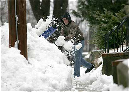
Jamie
Nelson of Peabody cleared snow yesterday
from Friday's storm. Rain turned the
region into a slushy mess. In Boston,
the storm ruined the city's bid to
escape with the least snowy winter on
record. (Globe Staff Photo / Dominic
Chavez) |
It looked like it was going to be
a record-breaking winter, a walk on the mild side
with hardly any snow.
But Boston's chance to break the record for the
least snow ever recorded was ruined by the storm
that dumped more than 8 inches on the city Friday
and early yesterday, according to the National
Weather Service.
As the wintry blast moderated to a light drizzle
yesterday morning, homeowners scrambled to clear the
heavy slush from sidewalks, alleys, and driveways.
"As Bostonians, we know we wouldn't have gotten away
into spring without a good snowfall," said Natanya
Brown, 27, who was leaving her South End home to go
to the gym. . . .
Snow-shoveling procrastinators were doomed to get
out the ice picks today, with temperatures expected
to drop below freezing last night, hardening slush
and puddles .
With spring only a few days away, only 6.4 inches of
snow had fallen in Boston by last Thursday. But then
the storm arrived Friday afternoon, piling 8.1
inches onto the total.
The record for the least snowy season in Boston was
set in 1936-37, when 9 inches of snow fell,
according to the National Weather Service.
Records have been kept since 1892. If the city were
to receive no more snowfall, this winter would be
the fourth least-snowy ever, said Nicole Belk, a
meteorologist with the National Weather Service in
Taunton.
No snow or rain is expected today. Belk said the day
would be mostly cloudy, with a high in the upper 30s
and an overnight low in the lower 20s. But tomorrow
may bring some light rain or snow, she said.
Spring officially arrives at 8:07 p.m. Tuesday.
Jack Gurnon, owner of Charles Street Supply Co. &
Hardware on Beacon Hill, said business was brisk
yesterday as he sold shovels, ice chippers, rock
salt, and Duraflame logs. Half a dozen customers
were lined up before he opened at 8 a.m., he said.
Others came in reluctantly.
"I've had a lot of people say, 'We're just going to
wait for the sun to come out next week.' And then
they come back later in the day after they try to
get their cars out or try to walk down the
sidewalk," Gurnon said. "A late-season storm is
always fantastic. I don't have to store anything
over the summer."
Yesterday's temperatures kept severe flooding at
bay, said Eleanor Vallier-Talbot, another
meteorologist with the National Weather Service.
Small streams and rivers flooded into backyards and
secondary roads in Bristol and Plymouth counties,
she said.
Few weather-related car accidents were reported
yesterday as the storm cleanup wound down, other
than a single-car rollover and a two-car crash on
Route 128 in Newton in the morning, said Sergeant
Robert Bousquet, a State Police spokesman. No
injuries occurred in either accident. . . .
Mayor Thomas M. Menino urged residents and business
owners to clear sidewalks for safety during today's
St. Patrick's Day Parade in South Boston.
The Boston
Herald
Sunday, March 18, 2007
Wave of wintry weather on way out
in Bay State
By O’Ryan Johnson and Laura Crimaldi
Ice-encrusted snow, again. Slushy
streets, again. Slippery sidewalks, again. SUV
drivers barreling down highways, lofting huge cakes
of snow from their rooftops.
Again.
Mother Nature threw another wintry party this
weekend and left us to clean up the mess.
The good news is, the wet weather appears to be
over, and while precious little sunshine is forecast
for today and tomorrow, temperatures are expected to
stay above freezing, with highs in the upper 30s and
westerly winds between 10 and 15 mph with gusts up
to 30 mph, according to the National Weather
Service. . . .
A flood warning was declared for parts of Plymouth
and Bristol counties, but fire officials in those
areas said they had yet to see rising water. “It’s
not bad at all,” said Plymouth Fire Lt. Jeff Aylward.
“I guess that’ll depend on the weather, but we
haven’t had any disaster and mayhem.”
State police meanwhile reported multiple spinouts
and a few overturned vehicles but no fatalities.
The snowfall total broke into double digits along a
band north and west of the city that stretched from
Newburyport (14 inches) to Worcester (16 inches),
according to spotters for the National Weather
Service. Boston Common recorded 7 inches, while the
city itself was hit with 9 inches.
The sun is expected to return Tuesday, lifting temps
above 40 degrees, and the weather service predicts
the mercury will top 50 by week’s end.
The Boston
Herald
Thursday, March 22, 2007
Spring makes a splash in the Bay
State
By Herald staff
The second day of spring will
bring a shower as the Bay State awaits sunny weather
and warmer temperatures.
Temperatures will be mild, in the 50s under mostly
cloudy skies, but pushing 60 degrees. Breezy wind
gusts around 16 mph will carry us into the afternoon
and evening as the skies gradually clear up.
Tonight, showers are expected
after midnight and the lows will dip to near 40.
Cloudy skies will give way to sunshine on Friday
morning. A high near 60 will also warm things up and
give the spring rain a nice send-off.
Expect weekend temperatures to be mild.
|

|

|