|
Winter 2008-09
March 1, 2009
As The Next Nor'easter Approachs
|
| Click
thumbnails below for a larger picture |
|
Sunday, March 1, 2009 |
 |
 |
 |
|
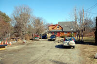
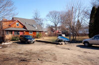
We've had unseasonably warm weather
for the past week, a mere dusting of snow since the last storm. That's
about to change, with another nor'easter bearing down on us starting
later today through tomorrow. (Mar. 1, 2009) |
The last storm on Feb 3-4 occurred
just in time to interfere with my planned surgery early on the morning
of the 4th. The procedure had to be postponed anyway due to an
unexpected upper respiratory infection, was rescheduled for --
tomorrow of course! |
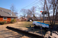
The ice and snow from previous storms
is gone. Even the dinghy is now accessible, an event I didn't expect
until April. With last week's unseasonably warm temperatures, almost
hitting 60� on Friday, spring -- now just 19
days off -- was in the air early. |
 |
 |
 |
|
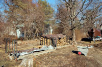
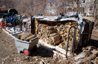
The warming was welcomed, especially
as the firewood racks are getting lighter, emptier. |
Of the full eight racks at the
beginning of this season, I'm down to two and a half. |
Even Mt. Chip Ahoy has been reduced to
a mere foothill, the only hint of snow remaining. |
 |
 |
 |
|
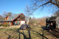
The tarp-covered picnic table and yard
furniture too are completely clear of snow. A month ago I didn't think
I'd be able to reach them either until April. |
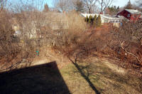
The picnic furniture and shed, from my
office balcony. Not a hint of snow remains. |
The birdfeeders out back, clear and
easily reached -- until tomorrow. But tomorrow I go in for my surgery;
the birds will have to fend for themselves until I can too. The hatches
are battened down for an expected 12" of new snow. Too bad I won't be
here to document this big one . . . (Mar. 1, 2009) |
|
More photos follow below
news reports . . . |
The Boston Herald
Sunday, March 1, 2009
Snow hot on trail of temperature swing
By Renee Nadeau
Don�t pack up that snow shovel - Old Man
Winter isn�t buried yet.
Light snow this morning will turn heavier in the afternoon,
when a winter storm warning goes into effect in
Massachusetts, said National Weather Service meteorologist
Alan Dunham. Expect 1 to 3 inches to accumulate before
sundown, and up to 6 inches by the time the storm warning is
lifted tomorrow afternoon. Areas west of Route 128 could see
between 6 and 12 inches. The Cape and Islands will see less,
as the snow is expected to mix with sleet and rain in the
southeastern parts of the state.
�It�s back to winter,� Dunham said.
High temperatures today will reach only the mid-20s, with
sustained winds of 10 miles per hour and gusts hitting 30.
Tomorrow will be similarly miserable, with highs in the
upper 20s and snow being blown about by 20- to
30-mile-per-hour winds.
�The morning commute is going to be ugly, and probably the
evening commute too,� Dunham said.
Sleet may accompany the snow at times, he said.
The Bay State has been pummeled by 55.2 inches of snow so
far this year, as of yesterday afternoon. Normal
snowfall at this point in the season is 31.1 inches,
Dunham said. Hardest hit this winter has been the western
part of the state. The Hub will be treated to partly sunny
skies Tuesday, with high temps in the mid-30s. Dunham said
we can expect sun and temperatures in the mid- to upper-30s
through Friday - nearly hitting the normal temperature of
40.
Associated Press
Sunday, March 1, 2009
Winter storm to bring snow
BOSTON � March is coming in like a lion.
A storm that could dump more than a foot of snow in parts of
the region is bearing down on Massachusetts and Rhode
Island.
The National Weather Service warns that Rhode Island and the
southeast portion of Massachusetts will see a dusting to two
inches of snow on Sunday with sleet and freezing rain along
the south coasts of both states.
That�s only the start.
A bigger storm will roll in starting at 10 p.m. Sunday and
could dump five to 15 inches of snow across southern New
England.
The heaviest accumulations will be west of Boston and in the
Worcester area.
Boston announced a snow emergency and parking ban taking
effect at 10 p.m. Sunday. Boston schools have been cancelled
for Monday.
The Boston Globe
Sunday, March 1, 2009
Snowy one-two punch to sock area
By James Vaznis
Cities and towns throughout greater Boston
are bracing for a major storm tonight that will extend into
the Monday morning commute, blanketing the region with about
a foot of snow and resulting in canceled classes in Boston
and other school districts.
�The morning commute will be an absolute nightmare,� said
Alan Dunham, a meteorologist with the National Weather
Service in Taunton.
The storm is the second-half of a one-two punch that is
socking the region. A smaller storm began this morning that
should yield 1 or 2 inches by the time it is over early this
afternoon. Even that storm has been creating trouble on the
roadways, making for slippery driving conditions that have
sent a few cars off the road. . . .
Tonight�s storm is expected to start by 11 and some areas
could see some sleet at first. Up to 8 inches could be on
the roadways by the morning commute. The snow is expected to
fall into the early afternoon, leaving about a foot of snow
in and around Boston. Areas north and west of Route 128
could get more than that, while the South Shore � which
could see a greater mix of snow, sleet, and freezing rain �
is expected to receive less than a foot. . . .
The Boston Globe
Monday, March 2, 2009
Area braces for heavy snow;
up to 14 inches expected in Hub
By James Vaznis
A steady snowfall last
night was expected to extend through this morning's commute,
forcing officials in Boston and many other cities and towns
to cancel school today.
With an accumulation of up to 14 inches expected in Boston,
4 to 8 inches of it by daybreak, "the morning commute will
be an absolute nightmare," said Alan Dunham, a meteorologist
with the National Weather Service in Taunton.
The storm was forecast as the second half of a one-two punch
that began hitting the region yesterday. A small storm in
the morning yielded 1 to 2 inches in some parts of Eastern
Massachusetts by afternoon....
Today's storm was expected to wrap up by early afternoon. It
could leave on average between 8 and 14 inches in and around
Boston, according to the National Weather Service....
"It looks like it will be a major storm but our hopes are it
won't have any icy components," said Peter Judge, a
spokesman for the Massachusetts Emergency Management Agency.
It has been a particularly snowy winter. As of yesterday
afternoon, 55.8 inches of snow had fallen in the area this
season, almost 4 inches more than last year.
The average is usually 34 inches.
The Boston Herald
Tuesday, March 3, 2009
Can you dig it? Storm smacks Hub
By James Hinton and Jessica Fargen
The Bay State is still
digging out after a late-season storm walloped winter-weary
New Englanders with nearly a foot of snow in Boston and more
west and north.
The Sunday night Nor�easter that extended into yesterday
morning left 7 inches of snow in Boston, and an afternoon
storm brought another 3 inches.
Light flurries are expected until midday today, but the
worst is over. The storm raised this season�s snow total to
just under 64 inches, almost double the annual average of
34.4 inches.
�It should be around 40 degrees this time of year,� said
National Weather Service meteorologist Bill Simpson. �It
will drop to the low teens or single digits for this week.�
The devastating effects of the massive storm included a
15-mile traffic jam in North Carolina that forced police and
the Red Cross to go car-to-car to check on stranded drivers.
The storm caused 350 crashes in New Jersey. A Maryland
official counted about 50 cars in a ditch along the highway.
Hundreds of flights were canceled at Logan International
Airport. Crashes in Boston and Connecticut on Sunday left
four Bay State women dead.
�There were a few spin outs, cars stuck in snow (yesterday)
morning,� said State Trooper Eric Benson, �but the weather
was bad enough people weren�t going too fast.�
|
Back from the hospital and home again:
Friday, March 6, 2008 |
 |
 |
 |
|
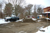
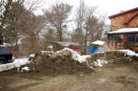
I got home yesterday from my surgery,
three days after the storm, and spent the night at
Barbara's house. This morning I slowly ambled back to my house, got my
camera, and shuffled out and around the lot to get these photos. (Mar.
6, 2009) |
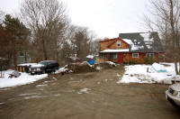
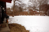
Ah, Mt. Chip Ahoy is back, though half the dirt lot seems
to have been added to it. |
Mt. Chip Ahoy seems to have grown a second peak, behind
it. |
 |
 |
 |
|
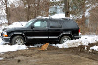
Barbara's cat, my good buddy Gilly, followed me step by
step all the way over a few steps ahead of me and looking back, then around the lot while
I came back out and took these photos, then back to Barbara's house when I
returned -- like Lassie watching over Timmy! |
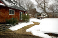
Thanks Bob Donovan and your snowplow crew for shoveling
out the path to the sliding kitchen door, the path from the outdoor
firewood racks to the indoor rack. |
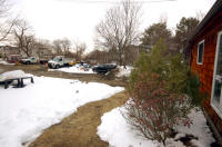
The side yard which, of course, after this storm has no
shoveled paths anywhere. Gilly's standing guard over me at the corner of
the cinder block foundation looking out back. |
|
|
 |
|
|
|
The temperature is supposed to climb into the sixties
tomorrow, fifties on Sunday, so most of what remains should melt away
over the weekend. With any luck, I won't even need to struggle to light
the wood stove. (Mar. 6, 2009) |
|
|
Dec. 28, 2008
| Jan. 1, 2009 |
Jan 11, 2009
| Jan. 18, 2009 |
Jan. 29, 2009 |
Back to Feb. 4, 2009 |
NEXT |
|
|
|