 |
Over the weekend of September 23-25, Barbara and I drove
up to Mount Desert Island for the mini-vacation I'd promised her while
laying over in Northeast Harbor for a few days during my cruise.
There, we took a tour of Acadia National Park and some of my sailing
haunts.
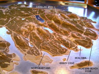
At the visitors center of Acadia National Park was a
large 3-dimensional bas-relief map of the island. This provided me
with a much better idea of what I'd cruised around -- and what led to my
almost-knockdown off the
mouth of Bracy Cove in a sudden powerful northwest wind funneled through
mountain valleys. (Sep. 24, 2005)
-- Click
for large graphic file -- |
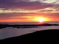 |
Barbara and I drove up to the peak of
Cadillac Mountain on Saturday. It's the first point on the U.S.
Eastern Seaboard to see the sun, so I decided to go for it the next
morning. Up and on my way by 4:30 am, I arrived to find one other
adventurer sitting in his solitude -- but by the time the sun peeked
over the horizon, we two souls were surrounded by a herd of some 40-50
others!
Beyond Schoodic Peninsula in this
photo, just beneath the horizon and to the left of the sun you can make out in the distance the lighthouse on the
seaward tip of Petit Manan Island,
and the treacherous Petit Manan Bar that I cut through with ease on an
even more clear day than this. You may need to open the large file
below then enlarge the photo to view this. (Sep. 25, 2005)
-- Click
for large graphic file -- |
|
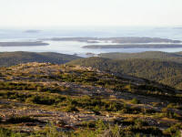
Northeast Harbor viewed from the
summit of Cadillac Mountain looking south. The Cranberry Islands
and Sutton Island lay beyond. |
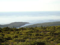 |
Bracy Cove -- the site of Chip Ahoy's
near-knockdown at its mouth.
A north, or in my case northwest, wind howls through the valleys and
bays between the mountains like a wind tunnel, racing for the ocean.
You can see the effect on the ocean in this shot with the wind out of
the north, but not even noticeable when we were at sea level in Bar
Harbor earlier. |
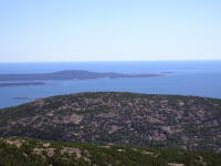 |
Schoodic Peninsula across the mouth of
Frenchman's Bay looking east. |
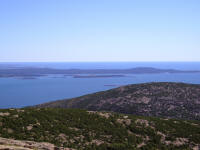 |
Schoodic Peninsula with
Winter Harbor on the left,
from which a sail boat is departing. |
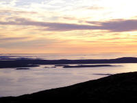
|
Schoodic Peninsula looking east with Petit Manan Island
(Chart) again in
the background. |
|
For Chip Ahoy's complete log of the 2005 cruise,
click
here |
|