|
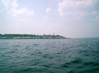
Sailing through Salem Channel between Bakers and Misery
Islands, Bakers Island and light. John called on the cell, decided to
sail around outside Bakers Island, to avoid the blanketing we'd hit if
going around the backside of Misery Island. A good call, I thought. (Aug. 17, 2009) |
 |
The backside of Bakers Island, the first time I've taken
this approach. The chart showed a good hole between the island and its
surrounding shoals. |
 |
Don with Bakers Island in the background. |
 |
Yours truly, wearing the pirate bandanna Barbara's
grandkids bought me from the Salem Pirates' Museum in Salem, while they
were visiting us. |
 |
Around Bakers Island and on our way back to Salem Harbor. |
 |
Oops, what's happening to our breeze? |
 |
Where'd that wind go? |
 |
Ah well, we're still moving, sort of. |
 |
But not much. |
 |
Ah, here it comes back. Pulling out of
the doldrums. This is apparently that forecasted wind shift from SW to
SE. |
 |
Don at the tiller, with Bakers Island and Eagle Rock in
the background. |
 |
The breeze finally picked up on our way back in. |
 |
Back in Salem Harbor John took a quick dip to cool off
from the 90º temperature. |
 |
Back on Chip Ahoy's mooring, John rafted Malacass us with
us for a while. |
 |
Don and I relax in Chip Ahoy's cockpit
before taking Malacass ashore to the dock, and the 'traditional' Chip
Ahoy sailing day cookout awaiting us up the hill. After dinner, John and
Don took Malacass out to its mooring from the dock down the street,
caught the launch back just before it ended service for the day at 10
pm. |
|
|
|