|
New England Monsoon
Season ‘06
May 8 - May 16, 2006
“Worst flooding since the 1930s”
And it just kept coming
down through June
June 26, 2006
"22.26 inches of rainfall in May and June,
the most in a two-month period since record keeping started in 1872 . . ."
"Who'll Stop The Rain"
by Creedence Clearwater Revival
LYRICS
I no sooner got the
forward hatch down a
week ago yesterday,
and temporarily secured with a large old granite cobblestone, than the
monsoon season arrived the following day. It's been raining ever
since, and there's no end in sight -- none through at least tomorrow
afternoon, for however long. In New England we don't have spring; we have an
annual monsoon season between winter and summer.
Here in Essex County, Massachusetts -- ground zero in the weather armpit of the nation
-- all the
nasty weather gathers as if attracted magnetically -- be it nor'easters
or monsoon rains -- coming at us from all directions, targeting New
England in general and the North Shore of Massachusetts in particular.
Whether it comes to us from the west, or up the coast from the south, it
funnels right into the east coast of New England -- then usually moves
just offshore where the low pressure becomes stationary, spinning
around out over the Atlantic, "backing in," sending bands of torrential
rain west to inundate us especially along the coast.
It remains stationary until the next low pressure
system moves in from the west and nudges the stationary low further
offshore, only to take its place. If we're lucky, we get a day's
respite between the arrival of the new low and departure of the offshore
low. Then the cycle begins anew.
This
aggravating pattern usually concludes sometime
after Memorial Day, making for an extremely short sailing season:
sometime in June through September, barring hurricane threats in the
fall.
I don't know why I foolishly keep thinking "this is
the year!" I'll launch "Chip Ahoy" and have it in the water before
Memorial Day Weekend. If we're lucky here, we may finally get a
few days to start working on our boats, readying them for launch before
the three-day weekend arrives. Launching and use is always
a post-holiday -- the unofficial start of the summer season -- event hereabouts.
-- Chip Ford
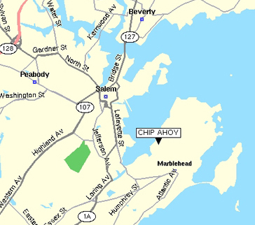
Marblehead, Mass.
May 15, 2006
Click on the thumbnail shots below
for larger images.
|
 |
 |
 |
|
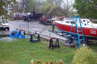
I got the
forward hatch
covered just in time last Sunday, not a moment too soon before New
England Monsoon Season struck the next day. (May 13, 2006) |
It's been raining since Monday with
no end in sight, through at least next weekend. But that's when
the next storm, now over the Great Lakes is expected to arrive and
start the pattern over again. |
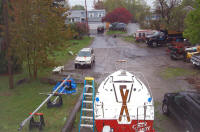
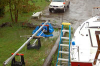
The ground is saturated, so out
little stream is beginning to flow across the driveway. Note the
granite cobblestone holding down the forward hatch until I can get
back out and add real hatch dogs. |
|
 |
 |
 |
|
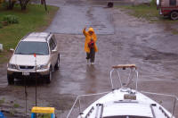
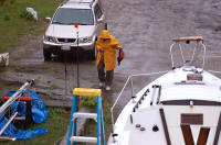
Barbara battling the elements,
treads carefully across the growing stream. |
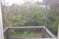
A view out to my backyard through the
office door as the deluge continues. |
This morning I couldn't take the
damp and cold any longer: it's in the low-40s and still pouring.
After over a month of it being idle, I fired up the wood-burning stove.
(May 14, 2006) |
|
 |
 |
 |
|
It's hard to tell in the photos, but
it can't rain any harder. The bands of torrential rain have been
relentless for days with no end in sight. |
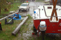
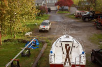
Wally Riddle's C22, "Carpe Diem," is
parked alongside my house, beneath overhanging trees. Fallen
leaves and leaf debris have again covered it, accumulated in its
cockpit and clogged its scuppers. |
It's time to again suit up --
foul-weather gear and boots -- and head out to unclog those scuppers
with my trusty toilet plunger, climb aboard and clear out as much
debris as I can -- until next time. Sure wish he had transom
scuppers! |
 |
 |
 |
|
While clearing "Carpe Diem's"
scuppers, I discovered why it was so chilly in the house this morning:
the pump hose in the cellar crawl space (accessible only from outside)
had loosened and was discharging inside instead of out! Some 7"
of water had killed the furnace. |
CLICK HERE!
At
about 7:00 PM on Tuesday, May 16, 2006 the sun returned just in time
to set. |
Finally, after eight days without it, the sun proved it's still up there behind all those rain clouds,
revealing itself at long last. |
 |
 |
 |
|
Hallelujah -- but will it last, or is more on its way? |
The
moon (it's still up there too!) and a flight into Boston's Logan International Airport float in
a clear, cloudless pre-dawn sky. The monsoon has ended, for
now. We have survived again! (May 17, 2006) |
The
first visible sunrise in nine days! Weather forecasts call for
seasonable weather through the weekend: partly cloudy with a
chance of scattered afternoon showers -- and reaching the 70s at last.
Now, maybe, we can get on with spring in New England? |
|
|
 |
|
|
|
How wet has this record-breaking monsoon season of '06
been? I've got a bed of huge mushrooms growing under Chip Ahoy --
something I've never seen before! But it looks like we launch on
Thursday at last. (Jun. 19, 2006) |
|
My Message to the C22 Discussion Group
Saturday, May 13, 2006; 7:09 am
Vaughn McGrath ("French Curves") contacted me
last night: launching his boat on Tuesday looks most unlikely.
Launching "Chip Ahoy" by Memorial Day Weekend is out of the question
-- again -- if this keeps up, and there's no end in sight.
It'll be another sometime-in-June splash for 2006.
New England winters are bad enough, but the springs (monsoon season)
are a real morale killer. Just as we begin feeling alive
again, survivors after six months of cabin fever stepping
tentatively from our shelters, our excitement is washed away by
continuous days and weeks of steady rain, more indoors huddling.
The North Shore where I am is one of the "isolated areas" that
expect up to 7" of rain over the next 24 hours.
This is still the offshore low that's been backing-in on us from the
ocean all week. It's only 46° here now. The warmest spot in
New England today will be -- Caribou, Maine, near the Canadian
border! -- in the mid-70s; far enough north to miss this ocean
storm.
"National Weather Service meteorologist Alan Dunham said . . . it
could be late next week before the region sees a clear sky again."
But that's about when the rain now over the Great Lakes is expected
to arrive over us.
Well maybe the week after that . . . or will the next one stall
offshore again as usual? Day after day the goal post keeps
moving further downfield, while no progress is made readying our
boats. If it were spring instead of monsoon season, I'd feel
negligent, guilty for letting so many days pass without getting a
thing done on the boat, readying it to launch. Instead, I feel
depressed, frustrated. Please excuse my venting.
Talk about a short sailing season?!?
|
|
The Salem News
Thursday, May 11. 2006
Editorial
Just your typical New England spring
"I thought it was May. What was I thinking?" a
shivering Lt. Gov. Kerry Healey joked to the small crowd that had
gathered at the edge of Salem Harbor Tuesday morning to hear about plans
for the resumption of ferry service to Boston.
She forgot, as do many, that there's no such thing as your traditional
spring in New England. Winter lingers here, then it's summer — which
arrives sometime after Memorial Day if we're lucky.
Oh, you might get a pleasant day here and there, which is why at
Tuesday's ceremony half were dressed for mild temperatures and the other
half for the tundra. Among the former was Senate Majority Leader Fred
Berry who quipped, "The only way I'm going to take the ferry is if it
has a heater."
And so it's gone this week. A stiff breeze off the ocean has kept
temperatures lower than normal; and a band of storms moving east and
stalling over the Atlantic is providing us with enough moisture to keep
the drought alarmists quiet for at least a couple of more weeks.
Wednesday morning brought a summer downpour — without the warmth — and
even some hail in a few locations.
Lest we complain too much, however, it's important to remember that our
proximity to the ocean, while a nuisance this time of year, is what
keeps us comfortable during the dog days of summer when others are
sweltering.
People might be moving south in search of a "real" spring. But we
guarantee they'll miss those glorious New England summers and falls.
Return to the top
|
The Boston Globe
Saturday, May 13, 2006
Massachusetts braces for expected
weekend washout of heavy rain
By Michael Naughton, Globe Correspondent
Cities and towns spent yesterday gearing up for a
heavy rainstorm expected to dump between 2 and 4 inches across much
of Massachusetts this weekend with some isolated areas receiving as
much as 7 inches of rain.
Meteorologists at the National Weather Service in Taunton expected
the storm to start last night and continue through tomorrow night,
with a chance of rain continuing through late next week.
The storm, an extension of a low-pressure system that is stalled
over the Southern Great Lakes, was anticipated to move slowly toward
the East Coast over a 72-hour period as of yesterday.
Communities on both sides of the Connecticut River Valley, from
Springfield and Chicopee to the Berkshires, as well as those within
the Merrimack River Valley, from Lawrence to Newburyport, are
expected to see the heaviest rain, accumulating 6 to 7 inches in
some areas, National Weather Service meteorologist Alan Dunham said
yesterday. Boston, like most of Southern New England, is expected to
receive 2 to 4 inches through tomorrow.
Massachusetts Emergency Management Agency officials said they will
bring National Guard troops to agency headquarters in Framingham
today in anticipation of the heavy rain and possible flooding.
Coastal flood watches were issued yesterday for much of Northeast
Massachusetts, including Suffolk County, warning of small-river and
stream flooding, street flooding, and possible beach erosion in some
coastal communities.
"Any time they talk about 3 or 4 inches of rain, I'm particularly
concerned even in spite of the recent drought," said Richard
Ferreira, director of emergency management for Taunton. Ferreira
added that city officials were keeping a close watch on the water
flow at certain privately owned dams. After a stretch of heavy rain
in October, officials feared that the 173-year-old Whittenton Pond
Dam could fail, causing major flooding in the city. The dam has
since been torn down and a stone structure erected in its place.
In Gloucester, Mayor John Bell said he met with public safety and
public works officials yesterday to prepare and implement the city's
command center to operate out of City Hall. Bell said one particular
concern was the Babson Reservoir Dam, which will be monitored around
the clock through the weekend because it is at a "relatively high
level." "We've been transferring several thousand sand bags from the
reserve to the DPW yard in the event they will have to be filled and
transported to sites," Bell said.
This weekend's storm could also be a challenge for the Massachusetts
Water Resource Authority, said its executive director, Fred Laskey.
He said that if water levels get too high, the MWRA will conduct
controlled releases into Boston Harbor to keep its pumping stations
active.
"We can take a pretty good storm. It depends on the duration. . . .
If we get 4 to 6 inches, we're going to be coming out everywhere,
storm drains will be flooding everywhere; there's no way around
that," he said.
In many communities, including Worcester, city officials made sure
to clear catch basins and check pumping stations.
"We're lighting very expensive candles in the cathedral here,"
Worcester Department of Public Works Commissioner Bob Moylan Jr.
said jokingly yesterday. "While ground water has risen over the past
couple of days, it's not fully saturated and that's going to be our
biggest benefit."
Although area officials said they kept a close watch on yesterday's
forecasts as they prepared their communities, meteorologists at the
National Weather Service and state officials said the long span of
dry weather leading up to this weekend may ease the brunt of the
storm.
"We don't expect the rain to be a huge problem," said Vanessa Gulati,
spokeswoman for the state Department of Conservation and Recreation.
"Because of the lack of rain in March and April . . . the streams
are low, the rivers are low. [The rain] shouldn't have a huge effect
this weekend."
Return to the top
|
 |
National Weather Service Bulletin
Bulletin - Eas Activation Requested Flood Warning
National Weather Service Taunton MA 752 PM EDT Sat May 13 2006
1115 - 752 PM EDT Sat May 13 2006
The National Weather Service In Taunton Has Extended The
* Flood Warning For Urban Areas And Small Streams In... Essex
County In Eastern Massachusetts. This Includes The Cities Of...
Newburyport... Lynn... Lawrence... Gloucester... Beverly,
Eastern Middlesex County. In Eastern Massachusetts This Includes The
Cities Of... Waltham... Lowell Southeastern Hillsborough County In
Southern New Hampshire This Includes The Cities Of... Nashua...
Manchester
* Until 715 AM EDT Sunday
* A Major Flood Event May Be Unfolding For Portions Of This
Region... Especially Essex County Where Monthly Rainfall Is Now
Over Over 6 Inches. Boston Already Has Recorded Its 8th
Wettest May In Over 100 Years Of Record Keeping.
Radar And Satellite Imagery Indicate A Conveyor Belt Of Heavy
Showers Over The Atlantic South Of Cape Cod Moving Ashore
Through The Plymouth Boston Route 3 Corridor And Heading Up Through
The Merrimack Valley Of Northeast Massachusetts And South Central
New Hampshire.
Two To 4 Inches Of Rain Has Already Occurred In This Warning Area...
Axised Near And East Of Interstate 93... From Manchester New
Hampshire To Lawrence And Medford Massachusetts. A General New
Rainfall From 8 PM Tonight Through 8 PM Sunday Will Be 2 To 4 Inches
For Eastern Hillsborough County Northern And Eastern Middlesex
County And All Of Essex County In Northeast Massachusetts.
Isolated New 6 Inch Amounts Are Possible.
So For The Rest Of This Saturday Evening... .Showers Will Be Briefly
Intense. This Will Evolve Into A General Persistent Drenching
Rainfall By Dawn Sunday With Nearly Constant Heavy Rain Anticipated
Between 5 AM And 3 PM Sunday.
Therefore... Any Recession Of Flood Waters That May Occur This
Evening Will Be Brief And Flooding Of Much Greater Extent Is
Expected In Portions Of South Central New Hampshire And Northeast
Massachusetts By Noon Sunday. This Will Include Increased Road
Closures... Possible Mud Slides... Stalled Cars In Poor Drainage
Areas And Possible Damage Due To Flooded Basements.
Sources Indicate The Ipswich And Aberjona Rivers Were Already In
Flood... As Well As The Proctor Creek. A Mud Slide Was Reported To
Have Occurred On Route 1 Earlier This Evening But Has Since Been
Cleared.
The Spicket River At Methuen Is Forecast To Go Into Flood Sunday
Morning And Remain In Flood Through At Least Monday Evening.
A Flood Warning Means That Flooding Is Imminent Or Has Been
Reported. Stream Rises Will Be Slow And Flash Flooding Is Not
Expected But Substantial Urban And Poor Drainage Flooding Will
Occur.
All Interested Parties Should Take Necessary Precautions
Immediately.
|
The Boston Herald
Sunday, May 14, 2006
Waterlogged Bay State braces for more rain
By Steven Ryan
The Boston area is overcompensating for a dry
April this month as the downpour that made for a soggy weekend is
expected to extend into the work week, according to the National
Weather Service.
"But too much of a good thing is not a good thing," said Alan Dunham
of the National Weather Service.
Flooding was reported yesterday in several Massachusetts
communities, including Hingham, Peabody, Wakefield, Salem and
Cambridge. The underpass at Storrow Drive also was flooded.
Communities such as Peabody were preparing for the worst while
hoping for the best, with high tide expected for around midnight
last night.
"We’ve already had lots of flooding downtown," said Lt. John Manning
of the Peabody Fire Department.
"We’ve also got sandbags around the downtown area if people want to
pick them up," he said. "We hired a few extra guys for details, and
they have pumps."
The wet weather will continue today as highs, like yesterday, hover
around 50 degrees.
It will keep raining tomorrow, with the next hope for dry weather
falling on Tuesday afternoon.
"We’ll have a brief glimpse of sun on Tuesday afternoon," said
Dunham. "Maybe."
|
The Boston Globe
Sunday, May 14, 2006
Plainly, the rain mainly stays
Deluge expected to continue through Tuesday
By Michael Levenson, Globe Staff
So much for brush fires.
After a month so parched it seared the landscape into a taupe
tinderbox of brittle sticks and yellow grass, relentless, pounding
rains deluged Massachusetts, swamping roads, flooding basements, and
turning moods as gloomy as the heavy gray skies.
More rain -- 2.03 inches, the equivalent of 20 inches of snow in
wintertime -- soaked Boston in just 12 hours yesterday than had
fallen in the city during the month of April, said William Babcock,
a meteorologist with the National Weather Service in Taunton. The
rain was predicted to continue through Tuesday and dump at least 5
more inches across Eastern Massachusetts.
Yesterday, pedestrians became silhouettes cloaked in fog, hidden
under umbrellas; stone walls hosted flowing waterfalls, and thick
clouds that shrouded the tops of skyscrapers swallowed the skyline
in downtown Boston.
Yesterday's match between the Red Sox and the Rangers was cancelled,
leaving dozens of fans marooned in the safe harbors of the Cask 'n
Flagon bar just outside the ballpark.
"It completely dampens your spirits," said Eddie Villafane, 29, of
Waltham, who lingered at the Cask 'n Flagon with a large group of
friends that had planned to attend the game. "I had hoped to be able
to go out and enjoy the weather."
Officials with the Massachusetts Emergency Management Agency were
worried that the storm could cause serious flooding today and
tomorrow, as the rain pushes rivers in the Merrimack Valley toward
their banks. Yesterday, there had been no calls to the agency for
relief from flooding or to evacuate residents, but the Ipswich and
Aberjona rivers in Northern Massachusetts were nearing flood levels,
officials said.
"Now, we expect small stream and urban street flooding throughout
all of Eastern Massachusetts and, getting into late Sunday and early
Monday, we expect most of the good-sized rivers to reach or exceed
flood stage," said Peter Judge, a MEMA spokesman. "How severe it is,
we'll have to wait and see."
Frederick Laskey, executive director of the Massachusetts Water
Resources Authority, said the agency had activated back-up
generators at the Deer Island Sewage Treatment Plant, to prevent the
sort of power outage that briefly hit the station last November,
causing some 25 million gallons of untreated sewage to empty into
Quincy Bay.
"We're basically at or near capacity on all our major facilities,
and it's running without incident," Laskey said. "It's a good storm,
and they're predicting it's going to continue on into tomorrow so
you never count your chickens until they hatch, but no incidents
today."
The flood watch presented a different sort of challenge for local
fire departments, many of which had spent the last month battling
the sporadic brush fires that flared in Attleboro, Quincy, Auburn,
and other communities.
"So far we've had just a bunch of flooded cellars, nothing out of
the ordinary that you wouldn't expect with a substantial rain," said
Steve Aiello, deputy fire chief in Gloucester, where officials were
worried about flooding at the Babson Reservoir Dam. "We've been
keeping an eye on some of the dams, and some low-lying areas, but so
far so good and we're keeping our fingers crossed."
As always in New England, some people managed to make the most of
the nasty weather. Among them was Donna Treadway, 64, a visitor from
North Carolina, who strolled outside Fenway Park, as dry as can be
under a wide umbrella.
"I do like walking in the rain," she said cheerily. "We'll get
enough hot weather this summer."
|
The Boston Herald
Monday, May 15, 2006
We’ve had it up to here: Flooding wrecks havoc
By Thomas Caywood
Three days of torrential rains, widespread
flooding, a state of emergency declaration . . . and the worst is
yet to come.
Downpours that had streams and sewers overflowing yesterday are
expected to continue thrashing the Bay State today, driving hundreds
more from their homes and flooding roads as the work week begins,
emergency officials said.
Massachusetts Emergency Management Agency spokesman Peter Judge said
the Mother’s Day weekend soaker is the wettest rainstorm in a
decade.
"This is going to get much worse," Judge warned. The worst of it was
expected to fall early this morning, but a second system packing
another 3 inches of rain is due in today.
"Spots in Essex County are going to top out at 14 inches of rain.
That’s amazing," Judge said.
Gov. Mitt Romney declared a state of emergency, allowing National
Guard units to be deployed to downtown Peabody, where cars stalled
in the 3-foot-deep torrent running down Foster Street.
Area dams were holding firm last night, but emergency officials were
watching those at the Upper Flint Pond in Tyngsboro and Upper Mystic
Lake in Arlington.
A handful of schools and even a Hampton Inn opened their doors on
the soggy North Shore last night to hundreds of people rained out of
their homes. Shelters opened in Amesbury, Methuen, Gloucester,
Manchester, Melrose, Peabody, Saugus, Winchester and Salem. About
300 people were expected at a Peabody shelter and another 150 at one
in Melrose, where sewage overflowed into homes. . . .
|
The Boston Globe
Monday, May 15, 2006
A deluge of woes for region
More to come after record rain triggers floods,
evacuations, emergency decrees
By Megan Woolhouse, Globe Staff
Three New England governors declared states of
emergency as torrential rains flooded parts of Massachusetts, New
Hampshire, and Maine yesterday, washing out roads, flooding
basements, and forcing emergency evacuations.
In Massachusetts, members of the National Guard and Red Cross and
emergency workers from 20 state and local agencies worked to
evacuate people in Peabody and Melrose after sewage backed up into
apartment buildings. Five feet of water sloshed over downtown
Peabody yesterday afternoon, rendering useless the sandbags laid out
on Saturday. In Melrose, local officials requested boats in case
they needed them to help rescue stranded residents, emergency
officials said.
With river levels rising throughout the region, and rain expected to
continue, emergency management officials predicted more flooding
over the next several days, especially in Middlesex and Essex
counties, the areas already hardest hit.
"This is going to get worse before it gets better," said Peter
Judge, a spokesman for the Massachusetts Emergency Management
Agency. "We're having a hard time anticipating how extensive the
damage will be."
Governor Mitt Romney, overseeing the emergency response from a
bunker in Framingham, declared a state of emergency early in the
day, activating the National Guard. Governor John Lynch declared a
state of emergency in New Hampshire, and Governor John Baldacci of
Maine issued a similar order for York County, in the state's
southern part.
"It's a very serious situation," Lynch said, adding that forecasters
were predicting 12 to 15 inches of rain by the end of the storm in
parts of southern New Hampshire.
The National Weather Service reported on its website last night that
record rainfall fell in Boston on both Saturday and Sunday. On
Saturday, 3.84 inches of rain were recorded, besting the old record
of 1.56 set on May 13, 2002. A record 3.36 inches had fallen by 9
p.m. yesterday, beating the previous record for May 14 of 1 inch,
set in 1882. Forecasters predicted several more inches of rain
today.
Walter Drag, a meteorologist for the National Weather Service in
Taunton, attributed the rainfall to coastal storms from the south
that encountered another jet stream system from Canada, forcing them
to hover over New England.
That has meant almost nonstop rain from Randolph to Manchester, N.H.,
and heavy rains throughout Eastern Massachusetts and the southern
parts of New Hampshire and Maine.
"We have been stuck," Drag said. . . .
Firefighters at Peabody's Lowell Street station answered calls to
help residents while struggling to keep their station dry, as deep
pools lapped at the back door. Pumps belched water out of the
station's basement since Saturday afternoon, but they could not keep
pace with the inflow. As much as a foot of water flooded the
firefighters' basement gym.
"This is unbelievable," Lieutenant John Manning said as he watched
people paddling canoes through downtown Peabody. "There's nothing we
can do." . . .
As residents of Boston and Milton frantically tried to stem water
rising in their basements, sales of sump pumps surged at Home Depot
in the South Bay Shopping Center yesterday.
By late afternoon, sales associate Kevin Harding said the store had
sold more than 1,000 cellar-draining pumps, which cost $64 to $200.
. . .
|
Associated Press
Monday, May 15, 2006
Romney declares state of emergency
BOSTON - Heavy rain forced evacuations in several
communities in Northeastern Massachusetts where swollen rivers
spilled onto city streets, basements flooded and residents endured a
dreary and soggy Mother’s Day.
Gov. Mitt Romney declared a state of emergency Sunday activating the
National Guard and other state services to help local officials
respond to the torrential rain that hasn’t let up since Friday.
"We have in fact had a couple of communities that have experienced
some high levels of flooding," Romney said from the bunker at the
Massachusetts Emergency Management Agency.
In downtown Peabody, about 20 miles north of Boston, cars were
pulled from flooded streets and about 300 people were evacuated from
a senior’s apartment complex. Businesses stacked sandbags at their
doors, trying to prevent damage from water that at one point rose to
waist-deep. Court officials planned to close Peabody district court
on Monday in an effort to keep people away from the city’s square.
"I’m flooded," Peabody resident Doug Jellison told WBZ-TV. "I’ve got
three or four feet in my backyard." . . .
Officials in the fishing community of Gloucester on the North Shore
also evacuated about 70 residents from Poplar Park senior home,
which is downstream Babson Reservoir spillway. The structure is not
endanger of collapsing, said Mayor John Bell.
The National Weather Service forecasted record flooding conditions
for rivers throughout the state, including the Spicket River in
Methuen, which is expected to rise 2 feet above the flood level by
Tuesday afternoon. The Merrimack River was expected to crest nearly
10 feet over flood stage by Monday afternoon.
Forecasters predicted the rain to continue through Tuesday and dump
at least 5 more inches across Eastern Massachusetts.
"This is the tip of the iceberg," said MEMA spokesman Peter Judge
said. "It’s going to get worse."
By Sunday morning, Boston had picked up 6.34 inches of rain in 30
hours. Farther north, Andover collected 9.8 inches over the same
period, according to the National Weather Service. . . .
|
The Boston Herald
Tuesday, May 16, 2006
Deluge drowns Bay State:
Evacuations spread as sewage spills into rivers
By Thomas Caywood, O’Ryan Johnson and Laurel J. Sweet
Rescuers scrambled to evacuate neighborhoods last
night as rising sewage-laden floodwaters menaced the Merrimack
Valley after a fourth day of relentless rain, with more on the way.
"We need the Federal Emergency Management Agency to quickly declare
a federal disaster, especially since the worst is yet to come," said
U.S. Rep. Martin Meehan (D-Lowell), who toured his inundated
district with Gov. Mitt Romney yesterday.
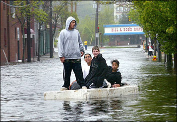
More than a foot of rain has hit Essex and Middlesex counties since
Friday, causing the worst flooding since the 1930s.
In Amesbury, two people who were thrown into the raging Merrimack
River when a dock was ripped away by the torrent were plucked out
alive by brave civilian boaters. In Methuen, workers kept a constant
watch on the 150-year-old Spiket Falls Dam and evacuated 450 people
downstream.
"If that goes, it would raise the level of the water 3 feet. All the
homes would need to be evaluated," said Methuen DPW Chief Raymond
DiFiore. A temporary walkway atop the dam collapsed last night but
the dam remained intact, buttressed by 3,000 sandbags.
State Sen. Steven A. Baddour, D-Methuen, said, "The concern is the
structural integrity of the dam. It’s a 2 a.m. cresting. So what
we’re worried about is making sure the sandbags on either side
hold."
In Lawrence, Mayor Michael J. Sullivan said about 400 people were
evacuated, while Haverhill evacuated 200 people.
The Merrimack roared over Lawrence’s Great Stone Dam, washing out
Pemberton Park.
"We’re trying to figure out where the water’s going to be two hours
from now, so before it gets there we can have people knocking on
doors to tell folks to get out," Sullivan said.
The flooding burst a Haverhill sewage pipe Sunday, spilling raw
effluent into the Merrimack River at a rate of 35 million gallons a
day. Officials fear that if a flooded treatment plant in Lawrence
loses power, it could cause a second major sewage spill, at a rate
of more than 100 million gallons a day.
The Massachusetts Highway Department reported a dozen major road
closures, including a roughly 20-mile stretch of Route 1 from Revere
to Peabody. Flooded cities and towns closed hundreds of local
roadways.
"It’s creating significant ripple effects," MassHighway spokesman
Jon Carlisle said of snarled traffic.
Meanwhile in Saugus, fearful of what more expected torrential
downpours might bring, town officials met with Army Corps of
Engineers experts last night and were ready to use boulders to try
to stem the whitewater spill-off from Walden Pond Reservoir that has
already turned Route 1 into an inland waterway.
|
 |
 |
 |
|
Boston Globe photo - May 16, 2006 |
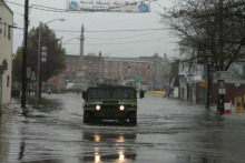
Salem News photo - May 16, 2006 |
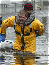
Boston Herald photo - May 16, 2006 |
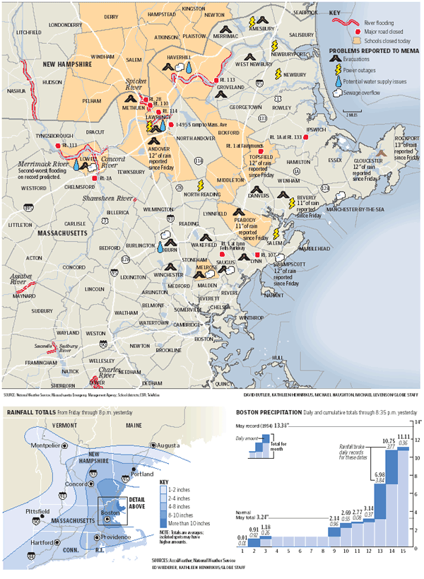
Boston Globe graph - May 16, 2006 |
The Boston Globe
Tuesday, May 16, 2006
Flooding besets region; more rain in forecast
By Brian MacQuarrie, Globe Staff
With rain-swollen rivers still dangerously above
flood level throughout Northeastern Massachusetts, water-weary
residents began to take stock yesterday of damage to homes,
businesses, and communities and braced for new problems.
Some of the most serious flooding to hit the state in 70 years has
plagued dozens of cities and towns, particularly in the Merrimack
Valley, with more than 1,500 people leaving their homes, millions of
gallons of raw sewage pouring into the Merrimack River, and
emergency officials warning that the worst might lie ahead.
The National Weather Service warned that dangerously high rivers,
such as the Merrimack and Spicket, were not scheduled to crest until
last evening and early this morning and that most of them would
recede very slowly. More rain was expected to fall north of Boston
again last night, adding about another inch of precipitation to
three-day totals that had been exceeded only once in the last
century.
"It's going to get worse before it gets better," Governor Mitt
Romney said yesterday afternoon after touring the hard-hit Merrimack
Valley. "This is a level of crisis which is beyond anything these
communities have ever experienced from water in their history."
Since Friday, 12.64 inches of rain had fallen in Rockport by 4 p.m.
yesterday, according to the National Weather Service. In Topsfield,
the total was 11.95 inches; in Gloucester, it was 11.75.
Romney said he would ask the federal government to declare the state
a disaster area, predicting that the flooding's cost would easily
surpass the $7 million threshold needed for US aid.
The governor said 35 million gallons of sewage had entered the
Merrimack River by yesterday afternoon because of a break in the
main sewage line in Haverhill. Officials feared that problem would
become much worse because a transformer for a regional waste-water
facility in North Andover had been flooded, threatening to spill 115
million gallons of sewage a day into the river.
National Guard troops, many of them veterans of the Iraq war,
enforced roadblocks and filled sandbags. The US Army Corps of
Engineers helped monitor dams. And rescue teams in Essex County and
northeastern parts of Middlesex County took to boats to ferry
residents to dry ground.
"This has been the worst flood that I've been through," said Peabody
Fire Chief Steven Pasdon.
"In terms of Saugus, it is a catastrophe," said Saugus Town
Administrator Andrew Bisignani.
Flooding also fouled the commute, closing Route 1 in Saugus in both
directions yesterday and forcing drivers from the North Shore and
nearby communities to use Route 128 and Interstate 93 to reach and
leave their jobs in Boston. As a result, 14 miles of Route 128
became a sodden stretch of nerve-fraying gridlock for much of the
day.
No deaths or serious injuries had been reported by last night. "We
still have a few more days of dealing with this," said Peter Judge,
spokesman for the Massachusetts Emergency Management Agency.
The problems throughout the region were many. Here is a compilation:
Sewer systems besieged
The rain overwhelmed sewer systems in at least seven communities,
leading to a major spill in the Merrimack River and backing up
sewage systems that pushed contaminated water into homes,
businesses, and roadways.
"The sewer industry in Massachusetts and southern New Hampshire is
under siege," said Fred Laskey, executive director of the
Massachusetts Water Resources Authority, speaking yesterday at the
massive treatment plant at Deer Island in Winthrop. "We've been at
full capacity here for about 48 hours; that's 1.3 billion gallons
per day. On an average day, we treat 350 million gallons a day. . .
. We're hanging on by our fingernails and hope to get through it."
Overflows occurred in Melrose, Haverhill, Swampscott,
Manchester-by-the-Sea, Saugus, Woburn, and Lowell.
The sewage spills and runoff from streets are raising concerns about
contamination of drinking water, particularly in Lowell and
Tewksbury, state officials said. Clean water supplies in those
communities are available for 24 hours, Romney said, in case
residents need assistance.
State officials will monitor the quality of river water, but
residents are being cautioned to stay out of the Merrimack River and
away from standing water in their streets. Shellfish beds and marine
life along the river could also be threatened by sewage flowing
downstream.
In Saugus, manhole covers popped off all over town, sending the main
pumping station on Lincoln Avenue into overdrive, and prompting the
discharge of about 4 to 6 million gallons of untreated sewage and
storm runoff directly into the Saugus River. The state allows such
discharge only in extreme conditions. Bisignani, the town
administrator, estimated that "99.9 percent" of the untreated flow
was composed of rain water.
Many fleeing the flood
Safety officials estimated last evening that 1,500 to 2,500 people
from 17 cities and towns statewide had left their homes, most of
them in the Merrimack River Valley. Mayor William Manzi of Methuen
said 400 residents had been ordered yesterday afternoon to leave a
downtown apartment complex near the dangerously surging Merrimack
and Spicket rivers.
Officials urged residents to leave their homes on the banks of the
Spicket River before nightfall made evacuations more difficult.
"The dam's 150 years old. If that let go, that would be devastation
for the downtown," said Matthew Kraunelis, the Methuen mayor's chief
of staff.
In Haverhill, buses were used to transport about 100 residents of
the Bethany Homes Senior Center to safer quarters. In Peabody, the
Fire Department and National Guard helped 250 people to move away
from the flood threat.
And in Lawrence, about 200 people left two neighborhoods of the
city, one near North Andover and one near Methuen. Many of the
residents found shelter at the Methuen High School fieldhouse. Water
rescues continued in the Merrimack Valley yesterday. "We're trying
to stay proactive and encourage people to get to higher ground,"
said Myles Burke, an aide to Mayor Michael Sullivan.
Traffic backs up
Flooding made driving an exercise in frustration and creativity
yesterday as hundreds of roads were closed throughout the region. In
Topsfield, Highway Superintendent David Bond said motorists had only
one way in or out of town.
The state closed sections of more than a dozen highways yesterday,
and officials predicted lingering disruptions for today and possibly
longer.
Jeff Larson, general manager of SmartRoute Systems, said he could
not recall more severe traffic problems caused by rain and flooding
during a weekday commute. The Route 1 closing, he said, had a huge
effect, as motorists scrambled to find alternate roads and possibly
encountered additional closings on secondary roads.
Mike King of the SmartRoute operations center estimated that
commuters spent twice as much time on the Boston commute yesterday
as they normally would.
Businesses absorb hit
The storm played havoc with the area's economy, disrupting thousands
of businesses that lost customers because of flooded parking lots
and closed roads.
Mary Ann Rogers, executive assistant of the North Chamber of
Commerce/Route 1 Advisory Business Association, said the shutdown of
Route 1 forced the closure of more than 100 businesses in the Saugus
stretch of the highway.
Heavy flooding caused by the swollen Saugus River, which swept onto
Route 1, forced the Prince Pizzeria & Bar to close. "It's
unbelievable," said Tricia Castraberti, wife of owner Steve
Castraberti. "You can paddle a canoe around the parking lot. No one
has ever seen it this bad."
Peabody officials estimated that 300 businesses had been adversely
affected by the rain, where the downtown area had been transformed
into a small pond.
Many schools shut down
More than a dozen school systems canceled classes yesterday, forcing
many to postpone high-stakes MCAS testing and instead open their
gymnasiums and cafeterias to those seeking shelter.
In Lawrence, the Spicket River flooded the boiler room at the James
F. Leonard School with 5 feet of water. In Methuen, school bus
routes were under water and dozens of residents were taken to the
high school on Ranger Road.
The flooding interrupted testing from elementary schools to
colleges. Statewide elementary and middle schools were supposed to
start MCAS testing this week or next. Some colleges were holding
final exams.
Lawrence, Lowell, Methuen, and nearby Haverhill canceled classes
again for today. The University of Massachusetts at Lowell closed at
3 p.m. yesterday and will be closed all day today; final exams will
be rescheduled for Friday and Saturday.
Middlesex Community College, with a campus in Lowell, is also closed
today and will reschedule classes. In Methuen, schools were
untouched by the floodwaters, but the high school quickly turned
into a refuge. Outside the hardest-hit areas in Essex and Middlesex
counties, many school systems were unaffected. Boston and Brockton,
for example, held classes as usual.
Michael Levenson, Mac Daniel, John R. Ellement, Steven A.
Rosenberg, Kathy McCabe, and Maria Sacchetti of the Globe staff and
Globe correspondent Caroline Louise Cole contributed to this report.
|
The Boston Globe
l May 23, 2006 |
The Boston Globe
Saturday, June 10, 2006
Freak system is blamed for rain
By Beth Daley, Globe Staff
A winterlike weather pattern that stalled off New
England has been the cause of all the misery since the start of
May: our soggy shoes, flooded basements, and submerged streets.
Meteorologists say that the jet stream, the strong river of air 7
miles above us, hasn't shifted northward as it usually does by this
time of year, to allow more summer-like weather to move in from the
South.
Instead, a series of low-pressure areas trapped by the jet stream
keep drawing up moisture from the Gulf Stream, the warm Atlantic
Ocean current, and spitting it back down on New England.
"If it was winter, we'd be getting snow, a lot of it," said Frank
Keimig, manager of the Climate System Research Center at the
University of Massachusetts at Amherst.
If the more than 18 inches of rain that has fallen on Boston in
May and June were snow, we would be digging out of 180 inches of
the white stuff.
Yet, there could be good news ahead. The sun may peek out as
early as tomorrow, and while there may be another storm
system Wednesday and Thursday, the rest of the summer is looking
normal for both temperature and precipitation, said Neal Strauss, a
National Weather Service meteorologist.
Today showers are expected in the morning and could occur throughout
the day, according to the Weather Service. Temperatures will be in
mid-60s. Tomorrow will be mostly cloudy with some chance of sun,
gusty winds, and highs in the 70s. A flood watch that was in effect
for the Boston area and much of Massachusetts last night was
canceled.
Scientists don't know precisely why they are now seeing this
weather, but they do know that a more powerful weather system that
blocks the jet stream to its northeast can cause colder than
normal temperatures and northeast winds.
Storms that are normally quick-moving can't blow out of the area.
They stick around for days, dumping enormous amounts of
precipitation back on New England. This spring, we have had a series
of those storms, three major ones in the last five weeks.
"Summer will come eventually," said Raymond Schmitt, a senior
scientist at the Woods Hole Oceanographic Institution who studies
climate. "Sometimes we just get stuck in a weather pattern."
Last month, the total rainfall was 12.48 inches at Logan airport,
9.24 inches above normal, making it the second wettest May on
record.
So far in June, Logan has measured 5.95 inches of rain, more than 5
inches above normal.
|
The Boston Globe
Monday, June 26, 2006
Record showers bring June glowers
By Adrienne P. Samuels, Globe Staff
If you think all this rain must have set some
sort of record, it has.
As of 8 p.m. yesterday, Boston had seen 22.26 inches of rainfall
in May and June, the most in a two-month period since record keeping
started in 1872.
As yesterday's below-average temperatures and overall sogginess
further dampened spirits, the two-month onslaught was taking a more
permanent toll on the local economy as flower-growers battled
water-borne plant bacteria, farmers struggled with sodden soil, and
popular outdoor tourist attractions lost profits.
"This is just like in 2005, one of the worst years for floriculture
in the state," said Robert Luczai , secretary for the Massachusetts
Flower Growers' Association. "We need some dry weather."
The National Weather Service is predicting a "precipitation-free"
day today, saying it will be partly sunny and humid, with highs
around 80.
Kim Buttrick, a meteorologist for the service, ascribed the poor
weather to a system she described as "a frontal boundary draped
across Southern New England," which is hosting warm, moist air along
with waves of energy. The weather pattern has stagnated, resulting
in days of rain. In addition, the temperature in Boston yesterday
afternoon was 66 degrees, 13 degrees cooler than normal, because the
wind was coming from the ocean.
"What we need is a good nice, dry, cool cold front to just come
sweeping from Canada across Northern New England to scour out this
humid and moist air," said Buttrick. "There's no sign of that yet."
The previous record for any consecutive, two-month rainfall was set
in 1955 , when Tropical Storm Dianne dumped nearly half of the 21.37
inches of rain that fell in July and August of that year. This month
is the third wettest Junes on record, with 9.78 inches of rainfall
as of last night, while last month was the second wettest May on
record, with 12.48 inches of precipitation.
The weekend rain did not approach the emergency levels of last
month's flooding downpours, said Peter Judge, spokesman for the
Massachusetts Emergency Management Agency.
Rivers are not overflowing, and there were only sporadic power
outages over the weekend, he said.
"Fortunately we've been very lucky with this in that, although we've
had a lot of rain, the real significant downpours keep moving
around," said Judge. "Although it's going to average 3 to 4 to 5
inches across the whole area, it's been off and on enough that the
water really hasn't impacted even the small streams."
All this water has affected drive times, Red Sox games, and the
state's flora.
Massachusetts flower growers are finding that their plants are
waterlogged, developing root rot, and, in the case of the
ever-popular fall chrysanthemums, becoming infected with a leaf spot
bacteria carried by water, according to the Massachusetts Flower
Growers' Association.
Growers are also lamenting a scarcity of buyers because Boston-area
homeowners are not rushing to plant geraniums in backyards full of
mud.
Some local farmers are taking a hit as well. Some Hmong farmers in
Lancaster have been flooded out of producing their usual supply of
bok choy for the Brookline Farmers Market, while other farmers in
central Massachusetts have been forced to increase their fertilizing
schedules because the rain washes away the nutrients.
Key crops such as tomatoes are slow to grow because of the poor
weather, said Glenn Stillman, of New Braintree, who grows fruits and
vegetables for at least six Boston-area farmers markets.
He said most other crops have yet to be flooded out by the severe
rainfall, but the weather is contributing to the delay of the
already short New England growing season.
"We had a great start in April because it was dry and everybody got
on their fields early," said Stillman. "But we haven't had great
weather since. Now what you're seeing is delay. Like if we thought
we'll pick tomatoes early, say by the Fourth of July ... now we're
saying it'll be two weeks after that."
Attendance at outdoor activities across the state has decreased.
Boston Duck Tours have seen a 6 percent decrease in customers,
yesterday's Red Sox game became the fifth rainout in the two months,
and Six Flags New England is seeing fewer visitors -- all because of
the rain.
"It's the downpours that have really put a damper on the tour," said
Boston Duck Tours general manager Cindy Brown. "The weekend is where
we're really feeling it because people might choose something
indoors like the museum instead."
Until things dry up, Boston drivers might want to start memorizing
the location of the city's foot-deep potholes, such as the one that
detained Patricia Woodsmoore, of Mattapan, on her way to church
yesterday.
Woodsmoore blew two tires while driving south on William T.
Morrissey Boulevard, near the Shaw's Supermarket in Dorchester.
Flood waters made the pothole invisible, she said.
That same hole has blown out several other car tires in the past
month and was just patched last week by the Department of
Conservation and Recreation.
The department has said that heavy rains cause the potholes to
worsen.
None of this made Woodsmoore feel better about her situation
yesterday as she watched a work crew put orange cones on both sides
of the hole, while she waited for help.
"You can't see the pothole because it's flooded," she said. "They
knew it existed. I want to cry."
|
 
|
|